Ministry of FLNRO
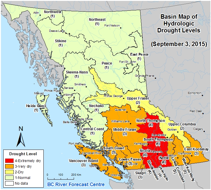
Basin Map of Hydrologic Drought Levels
This map is updated when conditions warrant. Click on the map or here to link to the 7-Day Average Streamflow Map for the WSC stations in the basins. More information on drought in BC is available at: http://www.livingwatersmart.ca/drought/.
|